Le Continental Divide National Scenic Trail est un sentier de randonnée de 3 100 miles (4 989 kilomètres) qui passe de la frontière du Mexique au Canada en passant par les montagnes Rocheuses . Pour la plupart des gens ordinaires, parcourir ce genre de distance à pied avec vos biens sur le dos ressemble à une forme de torture. Mais pour les quelques courageux qui le tentent chaque année, le Continental Divide Trail (CDT) est un défi à relever et à conquérir. Avec l' Appalachian Trail sur la côte est et le Pacific Crest Trail sur la côte ouest, le CDT forme les "trois grands" ou la "triple couronne" des randonnées longue distance aux États-Unis. C'est aussi le plus récent, le moins connu et moins populaire des trois.
Pourquoi le CDT joue-t-il le deuxième - voire le troisième - violon aux deux sentiers les plus populaires sur les côtes ? Principalement parce que le CDT n'est toujours pas terminé. En 1978, le Congrès a modifié le National Trails Act de 1968 pour former le Continental Divide National Scenic Trail, mais plus de 30 ans plus tard, le sentier est toujours inachevé, obligeant les randonneurs à emprunter des chemins de terre et parfois à traverser la nature sauvage afin de compléter leur voyage. En 2011, environ 832 miles (1 339 kilomètres) du sentier de 3 100 miles restaient encore à construire.
Ce n'est pas aussi mauvais qu'il y paraît, cependant; l'ensemble du sentier a été désigné, et les randonneurs qui empruntent le sentier ces jours-ci n'ont qu'à parcourir de petites sections (cependant, nous recommandons vivement d'apporter une bonne carte - ou plusieurs) [source : Service des parcs nationaux ].
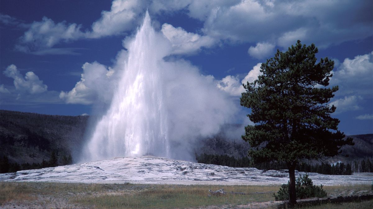
Alors pourquoi quelqu'un choisirait-il de parcourir le CDT plutôt que ses frères les plus populaires sur les côtes ? Parce que c'est peut-être la plus belle randonnée de toute l'Amérique du Nord. Le sentier serpente à travers le Nouveau-Mexique, le Colorado, le Wyoming, l'Idaho et le Montana, en passant par les parcs nationaux de Yellowstone , Rocky Mountain et Glacier. Mais ce n'est pas la seule raison pour laquelle le CDT pourrait être plus attrayant que les autres randonnées longue distance. Parce qu'il est inachevé, beaucoup moins de gens le parcourent chaque année - donc si vous le terminez, vous serez en compagnie d'élite. Et bien sûr, il parcourt le pays, du Canada au Mexique, donnant à tous ceux qui font de la randonnée un sérieux sentiment d'accomplissement.
Envie de faire une pause de quelques mois dans votre travail et de vous évader ? Ou peut-être voulez-vous vous rapprocher de la nature et vous mettre au défi physiquement. Les gens se lancent dans des randonnées de longue distance pour toutes sortes de raisons. On dit qu'environ 30 personnes seulement parcourent le CDT chaque année, et beaucoup d'entre elles le font probablement pour atteindre la "triple couronne". Que vous cherchiez à ajouter cette plume à votre casquette ou que vous vouliez simplement faire une promenade dans les bois, le Continental Divide est l'un des grands trésors de l'Amérique du Nord.
- Guide de randonnée Continental Divide: guides et cartes des sentiers
- Défis de la randonnée sur le sentier Continental Divide
- Faire du vélo sur le sentier Continental Divide
- Guide de randonnée Continental Divide: Alliance des sentiers de randonnée
- Note de l'auteur
Guide de randonnée Continental Divide: guides et cartes des sentiers
Parce qu'il est encore inachevé, il n'y a pas un seul itinéraire que tous les randonneurs suivent ; au lieu de cela, chaque randonneur sur le Continental Divide Trail a tendance à choisir son propre chemin. Il n'est donc pas surprenant que la navigation soit l'une des compétences les plus importantes requises pour parcourir le CDT. En d'autres termes, si vous prévoyez de faire de la randonnée sur le CDT, vous devrez certainement dépoussiérer votre boussole et vos compétences en lecture de cartes, car contrairement à de nombreux sentiers plus courts et plus établis, vous ne pourrez pas compter sur l'arbre flammes pour se rendre du Mexique au Canada.
Les guides sont un bon point de départ pour planifier votre randonnée CDT, mais ils ne sont pas la seule chose dont vous aurez besoin. Les guides officiels du CDT sont publiés par Westcliffe Publishers. Les livres de Westcliffe suivent l'itinéraire officiel du CDT, mais comme la météo et les sentiers inachevés peuvent nécessiter une certaine improvisation, les guides peuvent ne pas être utiles pour de grandes parties de la randonnée.
L'ensemble de guides non officiels le plus populaire pour le CDT est celui écrit par Jim Wolf, directeur de la Continental Divide Trail Society, communément appelé les «guides CDTS» ou les «guides Wolf». Les livres de Wolf sont généralement plus détaillés que la série de guides officiels de Westcliffe, et de nombreux randonneurs les ont signalés comme étant plus précis. Cependant, comme les conditions des sentiers changent constamment, la meilleure façon de savoir à quoi s'attendre est de s'abonner aux newsletters et autres forums Web qui sont mis à jour plus fréquemment que les guides imprimés [source : Continental Divide Trail Society ].
En plus d'offrir les guides de Wolf, la Continental Divide Trail Society vend également un ensemble complet de cartes topographiques étanches National Geographic pour plusieurs portions du CDT. De nombreux randonneurs recommandent également de s'approvisionner en cartes régionales produites par l'US Geological Survey et le Bureau of Land Management. Et c'est aussi une bonne idée d'apporter des feuilles de route pour les zones où vous prévoyez de quitter le sentier.
Comme tout outil, une carte n'est aussi bonne que la personne qui l'utilise, vous devez donc vous assurer de savoir lire correctement une carte de sentier et une carte topographique avant de vous lancer sur le sentier. Et que vous planifiez une randonnée d'un week-end ou une randonnée de six mois, c'est toujours une bonne idée de tracer votre itinéraire et de planifier vos points de repos et de ravitaillement à l'avance.
Qu'est-ce que la division continentale ?
More than just a trail, the Continental Divide is a natural feature that runs north and south across North America -- all of the rivers and streams on the east side of the divide flow into the Atlantic Ocean, while all the waterways on the west side flow into the Pacific .
Challenges of Hiking the Continental Divide Trail
Trying to chase a disappearing and often nonexistent trail isn't the only challenge that hikers will encounter on the Continental Divide Trail; they'll also face difficult and often forbidding weather conditions, steep terrain, dangerous wildlife and water shortages . Nobody said the CDT was a piece of cake, and that's partly what gives the few who complete the hike a true sense of accomplishment. Unlike more popular trails, like the Appalachian Trail, very few thru-hikers attempt to hike the entire CDT each year, so you might not encounter many other backpackers on some stretches. That means there is less room for error, because if you make a mistake and find yourself in trouble, there might not be anyone to come rescue you.
The first and most important thing to think about when planning a hike, regardless of the length, is where you'll be able to get fresh drinking water, because out on the trail -- especially at high elevation -- you won't be able to get very far without water. Finding good water is one of the primary challenges that thru-hikers face on the CDT, and because of frequent drought conditions in the Rocky Mountains , the situation isn't likely to improve. Because much of the CDT passes through public lands that are grazed by livestock, experienced CDT hikers have reported difficulty finding water that hasn't been contaminated by farm animals. The best advice is to stock up on water whenever you can find it, and to carry more than you think you'll need [source: Bureau of Land Management].
The weather is always a major intangible when you go on any long-distance hike , especially on the CDT. If you hike the entire trail, you'll be passing through both desert and alpine zones, and you'll likely experience everything from extreme heat to heavy snow, with a few severe thunderstorms sprinkled in for good measure. The key to surviving on the trail is going equipped with the proper gear and knowing when to pack it in when conditions become too treacherous.
Another factor to take into account if you're thinking about tackling the CDT is altitude. Much of the trail is located about 7,000 feet (2,134 meters), and for long stretches of it you'll be hiking above 10,000 feet (3,048 meters). Big mountains are of course what makes this trail exciting, but hiking at high altitude, where the air is thinner and you're closer to the sun, brings a whole new set of challenges. Most people tire faster and need to drink more water at high altitudes. Winds are stronger, and weather systems can blow in swiftly and without warning. And worst of all, hiking at high elevations can also cause altitude sickness, which makes you feel lightheaded and disoriented.
If all of that isn't enough to scare you away from the CDT, maybe this one will: bears. And not those cuddly black bears found on the East Coast. Hikers on the northern stretches of the CDT have been known to encounter grizzly bears, which can be very dangerous. Part of the reason many people are drawn to the trail is the opportunity to view wildlife, but grizzlies are best viewed from a distance [source: AP].
Biking the Continental Divide Trail

If the Continental Divide is such a spectacular hiking trail, it stands to reason that it would be a pretty excellent mountain biking trail also. But should a trail that is primarily meant for hikers be open to mountain bikers too? Trail purists, represented by the Continental Divide Trail Society, have long argued that the trail should be a "silent trail," open only to hikers and horsemen. However, the U.S. Forest Service doesn't share that view. In 2009, the U.S.F.S. decided to open parts of the Continental Divide Trail to mountain bikers [source: Repanshek].
The U.S. Forest Service isn't the only agency in charge of CDT, as the more than 3,000-mile trail also passes through three national parks and several Bureau of Land Management districts and wilderness areas. But the ruling still has significant implications for the trail's future. The Continental Divide Trail Society argues that mountain bikes can disrupt a hiker's enjoyment of nature, especially when bikers are permitted to ride at high speeds. It will be interesting to see if the ruling negatively affects the CDT's popularity among thru-hikers [source: Continental Divide Trail Society].
From the perspective of mountain bikers, though, it's pretty easy to understand why someone would be interested in biking the CDT. The Continental Divide passes through some of the most impressive landscape in the Rocky Mountains , and it attracts some of the most hardcore, adventure-seeking cyclists in the world.
If you want to bike from Canada to Mexico on a trail that is close to the Continental Divide, the Great Divide Mountain Bike Route is generally considered to be the world's longest mountain bike route, and because of the length and the rugged terrain it's also one of the toughest. Although it traces the same general course, the Great Divide Mountain Bike Route is different from the Continental Divide Trail. The route extends from Antelope Wells, New Mexico (just north of the Mexican border) to Banff, Alberta in Canada, whereas the northern terminus of the Continental Divide hiking trail is at the Canadian border in Glacier National Park.
Like the hiking trail, the mountain bike route traverses the beautiful grasslands, deserts and alpine terrain of the Rocky Mountains, but most of the ride is on doubletrack forest roads. Whereas walking the Continental Divide can take half of a year or more, the typical thru-biker can complete it in 10 weeks or less (and some extreme riders race it in two weeks or less) [source: Gorman and Earle Howells].
Cyclists typically start at the northern end of the trail and head south, beginning in late June or July. Any earlier, and you're likely to encounter a good amount of snow in the northern stretch of the trail.
The trail was developed by the Adventure Cycling Association, which scouted and mapped a route that would intentionally intersect with towns and resupply points roughly every day, so that cyclists don't have to carry too much in the way of food. Even still, water can be in very short supply on several stretches of trail, especially in parts of central Wyoming and New Mexico [source: ACA].
Continental Divide Hiking Guide: Hiking Trail Alliance

When you're hiking on a good trail, your focus probably isn't on the trail itself -- it's on the surrounding landscape and views. But an enormous amount of behind-the-scenes work and money goes into building trails, especially one that's as long as the Continental Divide Trail. Most national scenic trails depend on nonprofit organizations to blaze the trail , so to speak. These groups typically raise funds, pull together volunteers, provide support to government agencies and generally make sure that trails are safe and well cared for.
Unfortunately, in late 2011, the Continental Divide Trail Alliance -- the main nonprofit organization supporting the trail -- disbanded due to lack of funds. This is of course very bad news for the trail, especially considering that more than 800 miles (1,287 kilometers) of the trail still remain to be constructed. Prior to the formation of the CDTA, trail construction was moving at a sluggish pace because there wasn't a unifying force to help spearhead its development. In its 17 years, the CDTA helped to build 525 miles (844.9 kilometers) of new trail and to raise awareness.
"Increasing pressures from development in the West, rising land costs, and challenges with the longstanding down cycle in the economy threaten the completion of the Trail," wrote the CDTA in a statement [source: CDTA].
In 1995, Bruce Ward, the former president of the CDTA, founded the organization with his wife Paula. In its more than 30 year history, the trail regularly faced funding challenges, and Ward had to get creative with fundraising, getting corporate backing from big outdoor apparel brands. In a controversial move, the CDTA even allowed some sponsors permission to put corporate logos on signs along the trail. But ultimately, even creative funding strategies couldn't keep the CDTA afloat [source: Wilmsen].
With Continental Divide Trail Alliance out of the picture, the future looks somewhat uncertain for the CDT, but one thing remains almost certain: that people will continue to hike along America's backbone, through some of the most majestic natural scenery in North America. Despite the CDTA's surprise dissolution, work on the Continental Divide Trail continues. Various organizations in the five states the trail passes through are taking up the cause of completing trail. So far, groups like Volunteers for Outdoor Colorado and the Montana Wilderness Association have been mobilizing volunteers to help work on the trail. If you would like to volunteer to work on the trail, you can get in touch with the closest U.S. Forest Service ranger office or District Bureau of Land Management field office.
Author's Note
I haven't hiked the Continental Divide Trail, but given the challenges, I have an immense respect for anyone who has. Heck, I'd be proud to even hike 100 miles of the trail. I find it kind of amazing that the CDT still flies under the radar compared to some of the other, more popular trails in the U.S. But Americans have always loved an underdog, so it's easy to root for the CDT to be completed.
Related Articles
- A Guide to Hiking Buck Mountain
- A Guide to Hiking the Ozarks
- A Guide to Hiking the Sierra Nevada Mountains
- A Guide to Hiking in Sequoia National Park
- A Guide to Hiking Rocky Mountain National Park
Sources
- Adventure Cycling Association. "Great Divide Mountain Bike Route." (May 29, 2012) http://www.adventurecycling.org/routes/greatdivide.cfm?pg=more
- Associated Press. "750-pound bear is captured in Montana." June 20, 2007. (June 1, 2012) http://www.usatoday.com/news/nation/2007-06-20-big-bear_N.htm
- Bureau of Land Management. "Continental Divide National Scenic Trail." (June 1, 2012) http://www.blm.gov/nm/st/en/prog/recreation/continental_divide_nst.html
- Continental Divide Society. (May 31, 2012) http://www.cdtsociety.org/
- Continental Divide Trail Association. (May 28, 2012) http://www.cdtrail.org/
- Gardner, James Ross. "No. 32: The Continental Divide Trail." Esquire. Sept. 18, 2007. (May 30, 2012) http://www.esquire.com/features/esquire-100/continental1007
- Gorman, Jim and Earle Howells, Robert. "Bike the Continental Divide Trail, Multistate." National Geographic Adventure. March 2009. (May 29, 2012) http://adventure.nationalgeographic.com/adventure/trips/americas-best-adventures/bike-continental-divide-trail/
- National Park Service. "Continental Divide National Scenic Trail." (May 30, 2012) http://www.nps.gov/romo/planyourvisit/divide.htm
- Repanshek, Kurt. "Forest Service Open to Allowing Mountain Bikes on Continental Divide Trail, But What About Park Service?" National Parks Traveler. Nov. 17, 2009. (June 1, 2012) http://www.nationalparkstraveler.com/2009/11/forest-service-open-allowing-mountain-bikes-continental-divide-trail-what-about-park-service4938
- Thomson, Candus. "Deux chemins vers un objectif: Sentier de la division continentale." Le Seattle Times. 13 mai 1997. (27 mai 2012) http://community.seattletimes.nwsource.com/archive/?date=19970513&slug=2538889
- Warner, Ryan. "Continental Divide Trail toujours inachevé après 30 ans." Radio publique du Colorado. 28 novembre 2008. (31 mai 2012) http://www.cpr.org/article/legacy-archive-4516
- Wilmsen, Steven. "Continental Divide Trail défend le financement créatif." Poste de Denver. (31 mai 2012) http://www.americantrails.org/resources/funding/FundCDNSTadvert.html